
|

I downloaded the RideWithGPS cell-phone and computer apps in April and set it up in late July 2015. I've been attempting to write up something about my experiences using them since mid-August but every time I sit down to write I realize that I would rather be riding. It is now December and unseasonably warm days are still luring me to the road.
The app is available for iOS and Android phones. I am using my iPhone5. I have an unlimited data plan and a USB charger so I don't worry about draining the battery or running in airplane mode. This is somewhat different from using a phone without a connection to the cell-phone network as described by Jack Donohue in his blog post How to Turn an Old Smart Phone into a Bicycle GPS Unit. With my active phone, I can use Google Maps for routes while using RideWithGPS to record my ride, and I can call a friend or AAA for help. One of the negative aspects of having my active phone right in front of me is that it is hard to ignore calls from work.
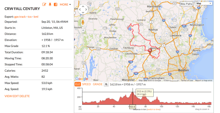
I downloaded the free RidewithGPS app from the iTunes store. it is available from the Google Play Store for Android phones. The companion computer app is downloadable from ridewithgps.com. I started with a basic membership ($50/year) and I've since upgraded to a premium membership ($80/year) just to try some of the extras. I really haven't done much of that yet. You can compare the plans here. I do like it that my ride information appears on my phone, iPad, and computer and that it is updated on all platforms as soon as rides are uploaded. I sometimes look over the ride summaries on my computer. Here's my CRW Fall Century ride. The image below is only a screen shot, but in RidewithGPS, you can slide the cursor along the elevation graph and the corresponding places on the map (blue dot). Any photos you take with the phone and select will upload with the ride information too.
![]()
![]()
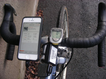
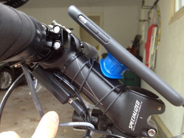
I have a Quad Lock phone mount. It’s very solid and rugged. You can mount the phone either vertically or horizontally. Mine is mounted on my handlebar (left). You can also attach it to the top tube or to the stem as my friend did (right).
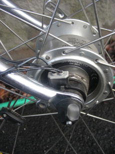 I am using a Shimano DH-3N71 dynamo hub to power both a Lumotec front light and my iPhone. A Shimano Connector Plug for Nexus Generator lets me run both the light and a USB charger from the hub.
I use a Sinewave Cycles Revolution USB charger and a 4 inch USB/lightning cable to go from the charger to the phone (shown above left). An
Android phone will have a different connector, usually a micro USB plug.
I find that I have to be moving at at least 8 kph (5 mph) for the phone to charge. The little battery icon in the upper right corner of the screen shows the level of charge and is green when actually charging. There is a short beep when charging starts. In the General setting on my phone I have set "Auto-Lock" to 2 minutes. That way the phone doesn't tend to turn off when I'm stopped at a light.
I find one anomaly when I run my light and RideWithGPS at the same time. If the charging stops because I've slowed down too much, I have to come to a full stop and start up afresh to get the charging to restart.
Bob Wolf, my bike club's GPS expert, points out that you can get power without a generating hub. He uses a lithium-ion battery in a top-tube bag with a 7” cable and gets over 200 miles of range for a day’s ride. John Allen notes that some battery-powered bicycle lights have a USB output and can double as an external battery for the phone. These lights typically have a big battery which can pick up when the phone battery would give out, and still power the light for an evening ride home. For more about desirable characteristics of lights, see LED-headlights.html.
![]()
![]()
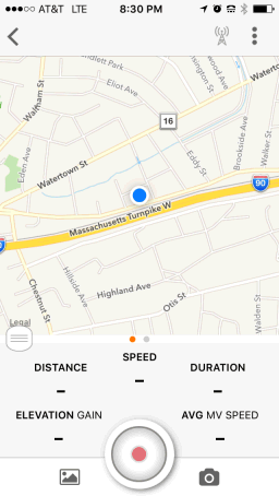
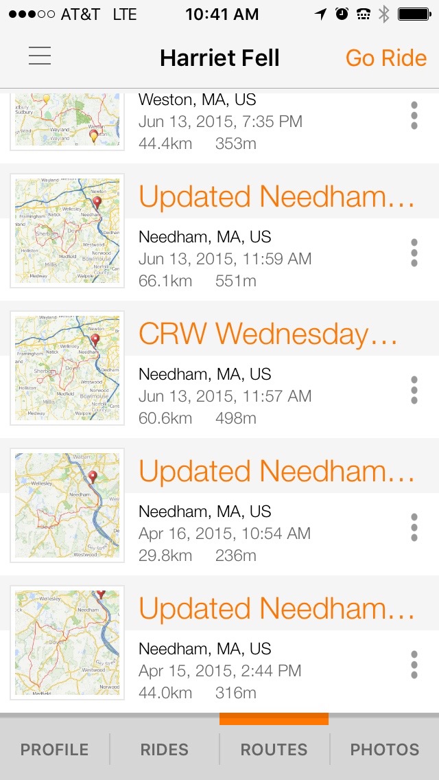
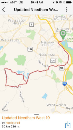
Once you COPY TO MY ROUTES, the route will appear as an option on your cell phone app. After you select a route (left below), the the whole route shows (center below). Then tap on the three dots in the upper right and select "Ride This" to get started (right below). The display will change to show just a small region of the route.
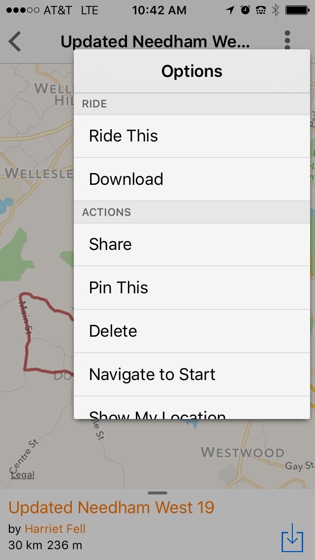
Pinning is another way to save a route. When you pin a route, you use the data someone else posted without adding a new copy to the RideWithGPS database. You can find easy to follow directions on pinning on the RideWithGPS site.
The Offline Maps iPhone option or Android option let's you download the maps and route entirely to your phone so you can navigate solely on the GPS in your phone even when you are out of cell range.
![]()
![]()
Before I got set up with generator and USB drive, I just used the phone in my shirt pocket - front or back. I can hear it except when announcements coincide with passing cars.
When I got the USB charger set up but the quad lock was still on order, I used a long USB-to-Lightning (Apple proprietary connector) cable to keep the phone charged in my pocket. Now I have a 4" cable that I got from Amazon. The cables are available in 5" and 6" lengths too, so make sure to get one that is right for your setup.
If you don't have a charger, you can set the app to only show the screen at turns so that it won't drain the battery quickly as in Jack Donohue's blog post mentioned above.
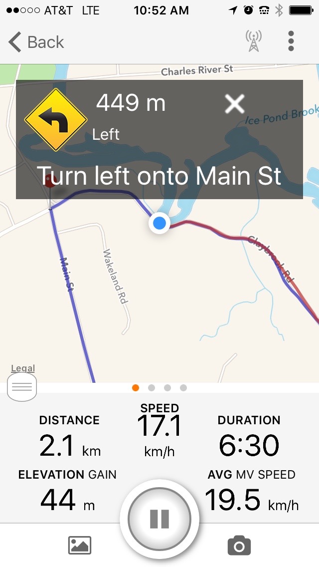
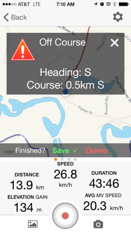
I like having the map in front of me as I ride. I can see what's coming up, and the announcements are also shown briefly in text (white on black above the map). There is a special sound to warn you when you go off course, and a message appears telling you how far off you are and which way you should be heading.
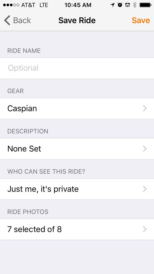
When you finish a ride, you can save it with map, data, and photos. I lost a few rides when I first started because I hadn't bothered to hit "save".
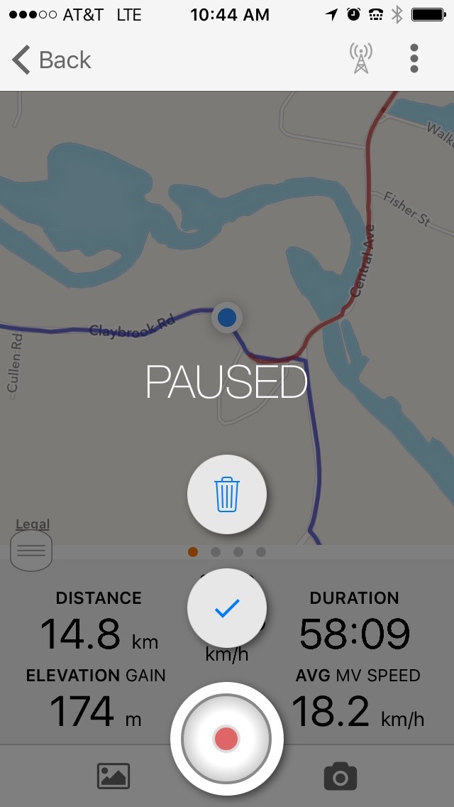
To save, first hit the pause button. That will bring up a screen like the one on the left below. Select the green checkmark icon. That will bring up another screen that lets you enter additional information, e.g. which bike you are using, a name for the ride, and which photos you want to keep. You must hit "save" in the upper right to complete the save operation.
You don't have to start a route from the official start point. I often ride from my home near Boston, Massachusetts to Dover, a town a few miles away. Three training routes start at Cutler Park in Needham, Massachusetts, and they are all still together at Claybrook Road in Dover. I use RideWithGPS to follow one of the routes back to the finish at Cutler park, and then head home from there.
I often use RideWithGPS to record my ride while I use Google Maps to provide a route. Google Maps does a pretty good job these days at coming up with routes that are suitable for cycling. This summer, I wanted to find a fairly flat century routes to ride on my own. I picked places about 50 miles from my house and used Google Maps to find routes there and back. When you ask for a bicycle route, you get back the altitude-change information as well as the route. I did one century from my house to Carver, Massachusetts and back and another to Swansea, Massachusetts and back. Google Maps did the directing, but RideWithGPS ran in the background and recorded everything. I did hit "save." Since I'm set up with a generator hub and a USB charger, the iPhone was fully charged all the way.
I now routinely use Google Maps on my bike to visit friends, get to points of interest, or to the start of club rides, and I run RideWithGPS to keep track of it all. While Google Maps is showing, a message blinks at the top of the display to assure me that RideWithGPS is running.
![]()
![]()
As with any app, there are likely to be some problems. The ones I've encountered with RideWithGPS have been minor, and some have already been resolved.
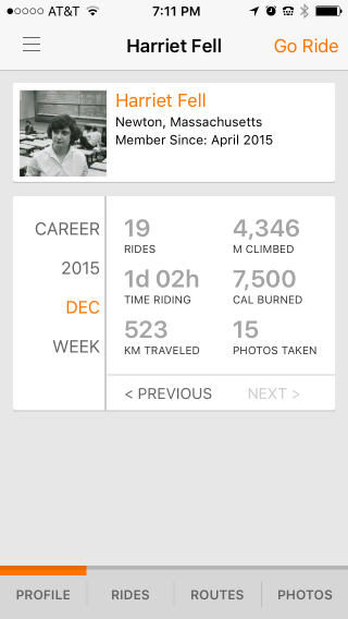
Sometimes the current month or week does not show up on the phone, though it does show on the computer. I found out from RideWithGPS Customer Service that this happens until a few days after the first Sunday of the month. I'm writing this on the first Sunday of 2016, and January 2016 does not show on my phone. I expect to see it in a few days, and probably this bug will soon be fixed in a software update.
I recently saved a ride but moved the phone around while the information was uploading and the result did not show up on my phone or computer. That's when I found out that you could enter ride information by hand--another neat feature of RideWithGPS. Two days later when I uploaded another ride, the missing ride appeared and I removed the one I had entered by hand.
I had problems with the app when it was 93°F (34°C). It may have been the heat and it may have been a loose cable caused by bumpy roads. The RideWithGPS app stopped working, but heat or a loose cable could interfere with any app.
Cold days can be a problem too. My generator keeps the phone battery charged when I ride at a reasonable speed. But it could not keep it charged on a slow ride, really a parade with many stops, on a cold day.
There is excellent help information on the RidewithGPS site at RideWithGPS Help. You really can find everything you need to know there, as I mentioned. Customer service is very responsive.
I'll end with a few other features suggested by Bob Wolf.
RideWithGPS offers many more features on its Starter, Basic, and Premium plans. We'll look, for example, at creating routes in another article. For now, you should have enough to get started so I suggest that you get out and ride with RideWithGPS. It's fun.
![]()
![]()
Last Updated: by Harriet Fell