
|
Tweet
Follow @sheldonbrowncom |
![]()

My family lived in France for about a year, in 1988-89. When we returned to the Boston area, we started taking vacations in Québec primarily as a way to keep our French in working order. We have taken a couple of Hostel trips in the area, first to the Eastern Townships (the area between Vermont and the St. Lawrence, also known as l'Estrie) then to Québec City, and to the Gaspé peninsula. We fell in love with the place and its people.
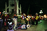
I am a fan of folk music in general, and Québecois folk music in particular. Much of the "traditionnel" Québecois music is a hybrid between French/Breton sources and Irish/Scottish styles.
My favorite Québecois group is called La Bottine Souriante, an astonishingly lively ensemble, who use sabots (wooden shoes) as their only percussion instrument.
Québec has a strong local contemporary music scene, and there are many highly-regarded singer-songwriters; my French is not facile enough to appreciate the texts of many of these artists, hélas!
Québec has the world's finest junk food, it is called "poutine", and you can get it in every roadside diner and unpretentious restaurant, to take out in paper boxes, or to eat in.
It consists of a mixture of:
MMMMMMMMMMMMM-MM!
They also have a very tasty sort of cold cut, which they call "smoked meat".
Unfortunately, while there is much of the French heritage that has been retained, the art of making good bread has virtually died out, and pasty U.S. style white bread is all that can be found in most smaller towns.
Canadian beer is not as good as German or Turkish beer, neck-and-neck with Mexican, but is much better than the Yankee or French product.
Canada is, alas, divided by the language question, and there is a certain amount of hostility between the language communities. From what I could tell, this does not extend to any particular hard feelings against Yanks in general among French-speakers. We found the people to be uniformly friendly and helpful; they seemed surprised and delighted to meet Yanks who could speak some French.

|
|
|

|
|
|
|
|
|
One of my favorite places is the Gaspé Peninsula, between New Brunswick and the Gulf of St. Laurence. [248k Map of The Gaspé Peninsula]
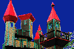
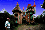
The southern shore, along the Baie de Chaleurs (Bay of Warmth) is a seaside resort area. [72k Map of the South shore] The cycling is not perfect, but isn't bad either. The bay is well named, and the swimming is good, at least to a New Englander like me. Don't miss the Chateau de Bahia youth hostel in Pointe-à-la-Garde, (H-6 on the map) if you go near it. This fairy-tale castle, pictured above, is made entirely of wood.

|

|

|
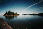
The tip of the peninsula is heavily touristed, but for good reason; the scenery is quite spectacular. Above is the famous Rock of percé ("Percé" is French for "pierced")
This is where the end of the Appalachian mountain range disappears into the sea. The Rock last gasp of the Appalachians. You can walk out to this enormous natural arch at low tide...it's not to be missed...just make sure you don't get stranded by the incoming tide!

|

|

|
In Percé, (M-5) don't miss a boat trip to Ile Bonaventure, a bird sanctuary and a great place to hike around. This is the principal rookery for the Northern Gannet, known in French as the Fou de Bassin. There are tens of thousands of them in the summertime.

|

|

|
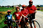
The tip of the peninsula is bifurcated, with Percé on the south and the Forillon National Park on the north point. This is a very cool place...watch out for bears, though! After my wife and son pushed their bikes to the top of the road to the light house at the tip of Cap Bon Ami, some passers-by asked my wife if she'd seen the bear that crossed the road right behind her! In this area, they need special armored trash cans to keep the bears out of the garbage.

|

|

|
We stayed at the Youth Hostel at Cap-aux-Os, at the edge of the park. While we were there, the Hostel had a big party, with a great traditional band, called "La Volute." They had my daughter dancing on the tables.

|

|

|
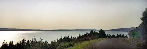
The northern shore, along the Gulf of St Lawrence, is very different. [114k Map of the North shore] Forested hills come down almost to the water's edge. There's a good, but lightly traveled road along the shore, and a railroad track...and very little else. Every 10-25 km you'll come to a little fishing village where a stream cuts through the hills to the Gulf. In between the villages, the coast is deserted. It's quite a contrast from the south shore. You'll need a good tolerance for cold water to swim here.
There are two good roads back across the base of the peninsula, if you want to make a loop tour. The shorter loop involves going back along route 299 from Sainte-Anne-des-Monts (H-2)to New Richmond(I-6), This runs through the Parc de la Gaspésie and the Chic Choc Mountains, along the foothills of Mt. Jacques Cartier (I-3). This follows the watercourse of the Cascapédia River.We drove this way, and stayed at the hotel at Mont Albert (I-3).
We did a bit of cycling along this road, it is excellent cycling. My wife and kids hiked up Mt. Jacques Cartier, which is an Arctic tundra near the summit...caribou may be seen. The Mont Albert hotel is excellent, an island of civilization out in the middle of nowhere. The food is spectacular, but surprisingly cheap, because it is an advanced school for chefs, and the students do the cooking. Highly recommended.
If you want a longer loop, you can go farther up the St Lawrence to Matane, (E-3)where there's another good road across the base of the peninsula, along the Matapédia River. This route comes out at Restigouche (G-7), at the tip of the Baie des Chaleurs, where there's a museum dedicated to the 1755 naval Battle of Restigouche, the last gasp of French military activity in North America.
![]()